
Who has two arms, likes taking self-portraits, and enjoys hiking
deep into the desert and sleeping in a tiny tent? This chick!

Fortunately (for me) that chick is my adorable wife, and
since I have also suffer from a pretty serious backpacking obsession, that
makes me a very lucky man! This weekend
we finally got the chance to indulge our backpacking fetish in a very remote
part of the world called the Escalante River Canyon.
How remote you ask?
I’m glad you did. The Escalante
River wasn’t even discovered until 1872, making it the last major river
discovered in the contiguous United States.
Even today, along it’s entire 90 mile length, only one bridge crosses
it. Simply known as the Highway 12 Bridge,
it wasn’t built until 1935 making Boulder, UT one of the last communities in
the United States to gain automobile access.
(Before I get to the hike I have to tell you about the drive there. As a man, I cannot admit to getting excited about fall foliage, but I can say this: The mountain views of the bright yellow aspens on a backdrop of dark pine trees, black lava rocks and red canyon walls were pretty much redonkulous. This part of the world is just silly beautiful. It continually amazes you - even when you aren’t looking for it.)
(Before I get to the hike I have to tell you about the drive there. As a man, I cannot admit to getting excited about fall foliage, but I can say this: The mountain views of the bright yellow aspens on a backdrop of dark pine trees, black lava rocks and red canyon walls were pretty much redonkulous. This part of the world is just silly beautiful. It continually amazes you - even when you aren’t looking for it.)


Our hike started in the tiny town of Escalante (population 797) where we left our car behind the cemetery and hiked down a dusty dirt path to the mouth of the canyon. From there it was a very twisty 15 miles to that one bridge on Highway 12.
How twisty you ask? Good question! The Escalante River has
been called “The Crookedest River in the World”. And while that may be difficult to prove,
let’s just all agree that it was pretty darn crookedy.


Why did we pick it from all the awesome hiking choices in
the area? Excellent query! Partly because it fit all of our “must haves”
– a babbling brook, awesome scenery, and a lack of other humans. And partly because this canyon (amazingly) still
lies outside any National Park meaning we could bring Maggie along - who has
been pretty miffed about being left at home on previous hikes.
And so off we went.
Three days, two nights, and everything we need to survive strapped to
our backs. Not even Maggie gets a free ride.
She carries her own food, bowl, and her wee lil’ boots in her very own doggie
backpack.

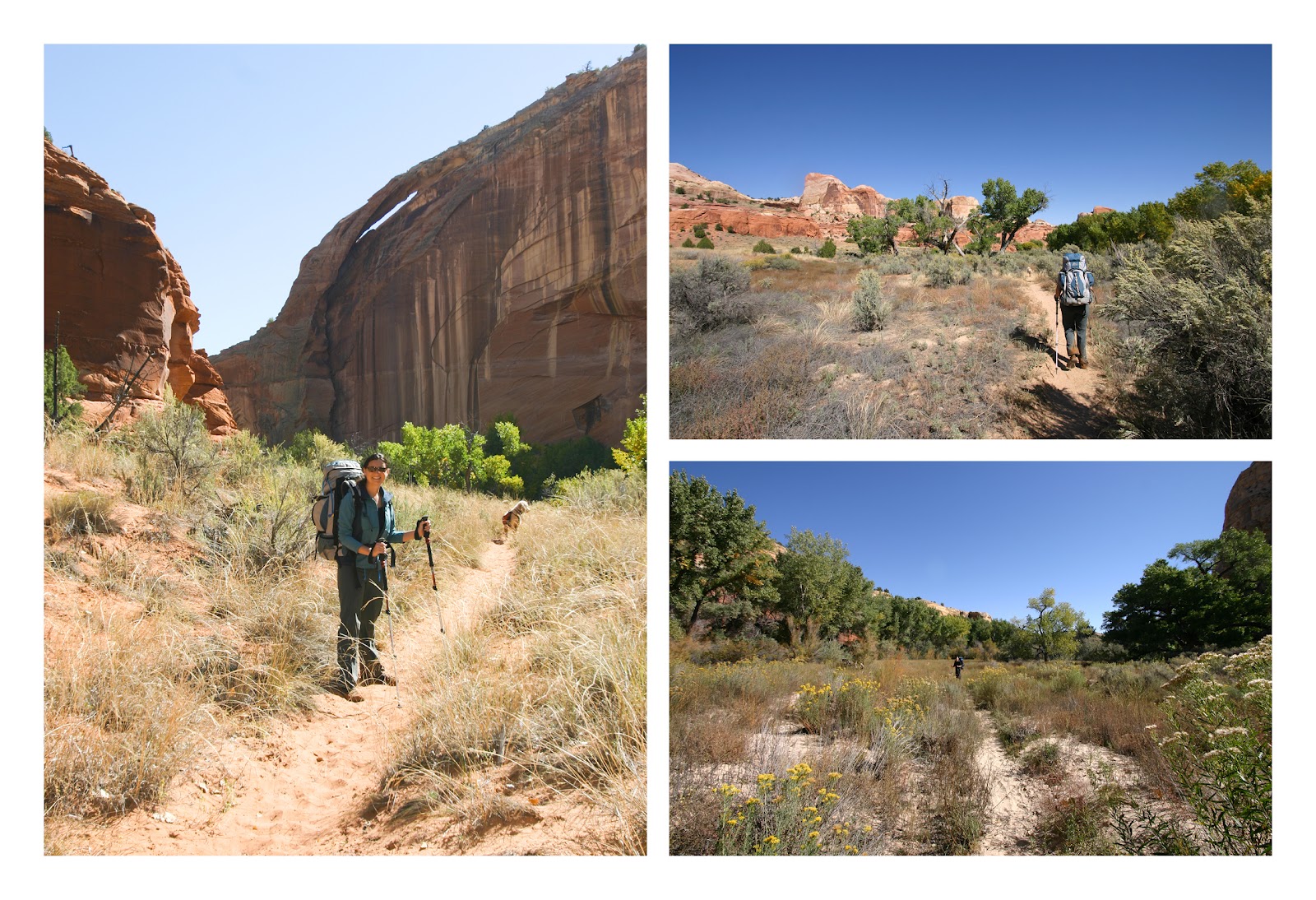
Once again, the scenery was spectacular. The canyon with it’s crazy high cliffs in crazy colors, twisting back and forth on itself so you can never see more than a few hundred feet ahead or behind. The bottom of the canyon a garden of grassy fields, sculpted rocks, and huge green and yellow cottonwood trees along an ankle deep stream – perfect for hiking in.

The first day we hiked in about 4 miles, passing possibly the coolest campsite either of us had ever seen. A huge alcove (a.k.a. shallow cave) a hundred feet high, a hundred feet deep and hundreds of feet wide carved into the sandstone. Pictographs made by the ancient Anasazi people - who also must have also camped here - decorated the back wall. Unfortunately it had already been claimed by other backpackers (the only ones we saw all weekend).

And so we headed on down canyon, soon finding an idyllic spot of our own in an open field by the river surrounded by massive cliffs on all sides.

Day two we continued down the canyon another 7 miles or so, past
more incredible scenery, stumbling across more prehistoric wall art.


The real highlight of the trip was where we stopped to camp
the second night on a sharp hairpin turn in the river. The inside of the bend was a wide soft sandy
beach backed by towering green and yellow cottonwood trees. The outside of the bend was a sheer, smooth,
concave, pink colored cliff - curving around us and over our heads to a
dizzying height. From the topo map it
looks to be about 500 feet high – or about a 50 story building.

Day three was a final 4 miles as the canyon widened. More wading in the stream and hiking through
grassy meadows between the canyon walls.
As a final highlight, we passed two huge natural arches, one of which
had the remains of an ancient Anasazi home built high into the cliff below the
arch. How they got up there, how they
built it, and how it is still standing (even the wooden roof is still intact!) makes
my face twitch just thinking about it.


... and finally the fantastic drive home.

Up next… Hiking with the Huxters! (The other Huxters!)
No comments:
Post a Comment