Tuesday, November 27, 2012

Kanarra Creek - an experiment in hypothermia


You'd think we would know better.

Stephanie grew up in South Carolina, proving she know better than to mess with cold water.  I, on the other hand, grew up in Newfoundland, which for all intents and purposes is the North Pole (see the map in the Bryce Canyon Post).  Up there it starts snowing before Halloween and carries on pretty much non-stop until Easter.  If you are lucky, it warms up enough for it to all melt by Memorial Day.  That gives you three lovely months of wind and rain before it turns back into snow again.

One thing that you learn quickly in a place like Newfoundland is that staying warm - and especially dry - is not just nice, it is a necessity. Those who fail to learn this at a young age, generally don't make it to an old age.

Once when I was quite young we were walking across a frozen lake to our cabin when my father made a rare lapse in judgement, failed to test a weak spot of ice and fell through up to his neck.  I have vivid memories of him jogging around us in circles trying to stay warm (and keep his clothes from freezing solid), as we hurried to the cabin and the promise of dry clothes and a warm fire.

Why then, 30 years later do we find ourselves purposely dunking our feet into icy cold water in a frozen stream miles from our car? Let's just say it was an experiment - one that was to prove beyond a shadow of a doubt that it was indeed far too late in the year to be doing  hikes in canyons with running water.

The canyon was carved by Kanarra Creek, creating another gem of a hike just north of us outside the town of Kanarraville.  The creek makes up the entirely of the small town's water supply, and so understandably, they politely request that if you hike there, you leave your dog at home.  Considering Maggie's general aversion to cold water (something she learned from Stephanie I am sure...) it was probably a good thing anyway.
At about 6000 ft elevation, there was already snow on the ground and the small stream was just starting to freeze.  Crossing the creek on the smooth ice covered rocks was a bit like trying to hold your balance while stepping on a loose pile of lightly buttered bowling balls.
We were able to keep our feet dry for most of the hike in, but once the valley narrowed into a tight slot canyon, walking in the water was the only option.  So on top of the slippery rocks, the the ice cold water left us with virtually no feeling below our knees.   It is surprising we didn't bust our butts more than we did.
The highlight of the hike was a short but spectacular slot canyon with a small waterfalls that you had to climb past using possibly the most rickety ladder we had ever laid eyes on.
All in all, we spent about 30 minutes exploring and photographing the canyon, all while trying to stay out of the water as much as possible, and trying to ignore the frostbite that was clearly setting into our toes.
When we got back to the car later that afternoon, we laughed at our frozen pant legs, and as we untied our frozen shoe laces, decided that perhaps we would choose dry canyons in the future - or at least until spring.

Up next... The North Rim - The Grand Canyon, but backwards!

Sunday, November 25, 2012

Stay tuned...


We would like to take this opportunity to address some of the recent complaints we have received regarding the frequency of our blog updates.

Without mentioning names, one person in particular (who, for the sake of privacy, we will simply call "my brother") thinks that "12 days is far too long without a blog update", and has hinted that perhaps we should spend less time working, eating, sleeping and doing those other annoying things that don't make good reading material, and spend a little more time hiking, writing, and posting pictures.

Well, you spoke, and we listened.  We spent every spare moment over the past few weeks  driving to more beautiful parts of the Southwest, hiking more amazing trails and canyons and taking pictures of more incredible scenery - and all for you.  It is a rough life, but we are committed to our readers.  And to prove it, over the next 12 days we promise no fewer than four blog updates:

1) "Kanarra Creek - An experiment in hypothermia."
2) "The North Rim - The Grand Canyon - but backwards."
3) "Buckskin Gulch - The most dangerous hike in North America", and
4) "Random stories and photos and stuff - A collection of awesomeness"

You aren't going to want to miss these.

Why insulated rubber boots are a great invention.  How to freak out speeding tourists using only a mannequin.   What is creepier than a giant noisy rattle snake.  Why you can't trust the internet.  What Maggie is looking at in this photo...


These questions and more will be answered... stay tuned.

Monday, November 19, 2012

Cedar Breaks (it also smells nice!)

After our long (long) backpack along the West Rim, we were ready for something a little shorter last weekend,  so we decided to take it easy (relatively) and check out Cedar Breaks National Monument.


I'm not exactly sure what the difference is between a National Park and a National Monument - they seem pretty much identical to me.  At first I assumed monument meant there was - well - some sort of monument there.  Like a statue.  Nope.  They are both basically large areas of scenic wilderness with view points, hiking trails, and a small ranger booth to collect your money and answer questions for old codgers in camper vans.


Cedar Breaks could almost be mistaken for Bryce.  It is like Bryce's little cousin.  A huge canon valley full of multi-colored cliffs and spires of sandstone standing like an army of drip sandcastles.  It is just a little smaller (and graciously free of tourists!).


Like Bryce, it is fairly high up in the mountains - in this case right around 10,000 ft - which means while it was still relatively warm in St, George, with leave leaves changing colors and such,  it is downright cold at Cedar Breaks.  Leaves?  Long gone.  Replaced by ice covered twigs and relatively annoyed looking squirrels.

This high up, there is already snow on the ground.  The park (or "Monument"... whatever...)  is already closed for the winter.  The rangers are gone and the facilities are boarded up - but the road is still open.  Once the snow really hits, even the snow plows get scared to be up here, and they just stop plowing - then it's all over until the roads melts free in the spring.


We decided to take advantage of the closure, forgo the silly rule banning dogs, and brought Maggie along.  Yup, we're rebels.

(Let me say again how annoying the anti dog rules are out here...  Don't want our dog in your restaurant?  OK - understandable.  Don't want her in your 1 million acre wilderness?  That's just being silly.)

So the three of us hiked an excellent trail about 4 miles out and back around the rim of the canyon.  On one side, a sheer cliff of several hundred feet opening up to a huge desert valley of sandstone creations.  On the other an ancient pine forest.  Old twisted trees, some as much as 1700 years old, surrounded in snow and fed by a tiny frozen stream.


Having grown up in Newfoundland, snow and frozen streams are fairly common to me, and so I spend most of my time looking towards the canyon.  For Stephanie, having grown up in Hilton Head, snow is still fairly novel, and so she spent most of her time taking pictures of the forest.  As for Maggie, just getting to go with us was enough. She was just happy to finally have some snow again to roll around it.


On the way home we swung by Brian Head, a small ski hill in the area that we intend to spend a lot of time at this winter - me skiing, Stephanie curled up by the fire with a hot chocolate and a good book.  It is the highest peak in the county, and there is a road open to the summit, so we took the new wheels up for a spin.  You could see all the way across Utah and into Nevada and Arizona.


Up Next... Kanarra Creek.

Tuesday, November 6, 2012

Two days on Zion’s West Rim Trail

So…. apparently the desert does get cold in the winter.  Who knew?

St. George is at a relatively low elevation (about 3000 ft) so it stays fairly warm all year.  (Stephanie confirmed that before agreeing to move here.)  Most of the best hiking however is up in the surrounding mountains and canyons between 5000 and 10,000 ft and it gets a quite a bit colder up there.  We had our first real taste of it last weekend on the West Rim trail.

The West Rim Trail.  I like the sounds of that.  Sounds impressive - kinda like we scaled Everest.  I can hear myself now, all withered and old and crotchety sitting in a rocking chair, shaking my cane at the young’ins and their “rock and roll” music, and telling anyone who will listen about how when I was just a wee lad, we were high up on the West Rim when a Nor’wester rolled in and we were trapped for days in the snow with nothing to eat but our shoe laces.  It’s not true of course, but I’ll be pretty darn old, so people will nod and pretend they’re interested.  (They’d better - or I’ll give them a good whacking with my cane!)

Well it wasn’t quite Everest, but it was a feet pounding 14 miles.  Add to that, most of the trail is at about 7000 ft and between the packs, the distance, and the relatively thin oxygen, it was tougher than it sounds.

Getting to the trailhead required hiring an hour long early morning shuttle, so we climbed out of the van to start our hike, just as the 
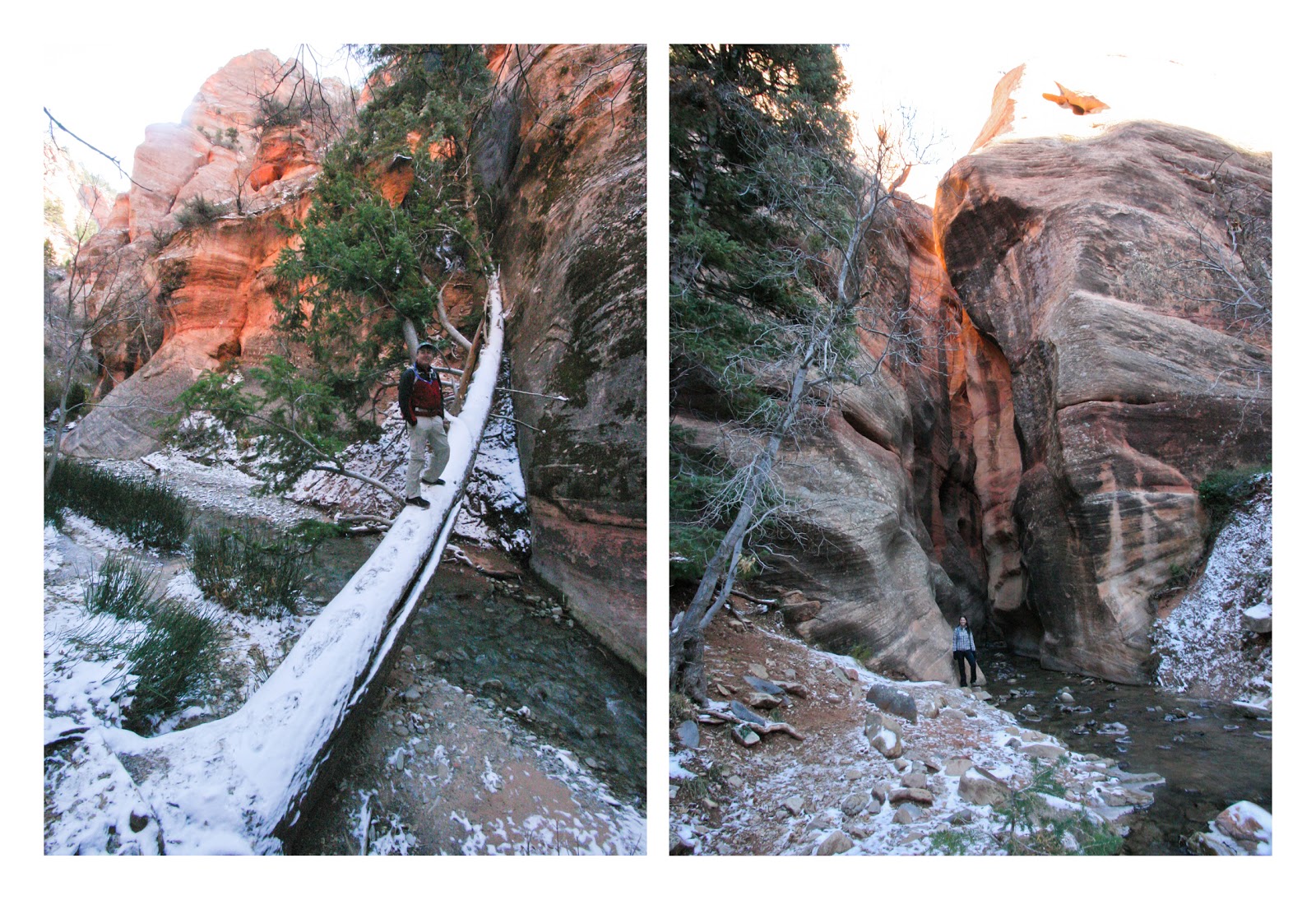
sun was coming up – at 7400 ft and a brisk 24 degrees!  We knew we were in for a chilly start when we noticed that a pond we passed was frozen over.  That’s never a good sign when you realize the next time you will step indoors is still a day and a half away.


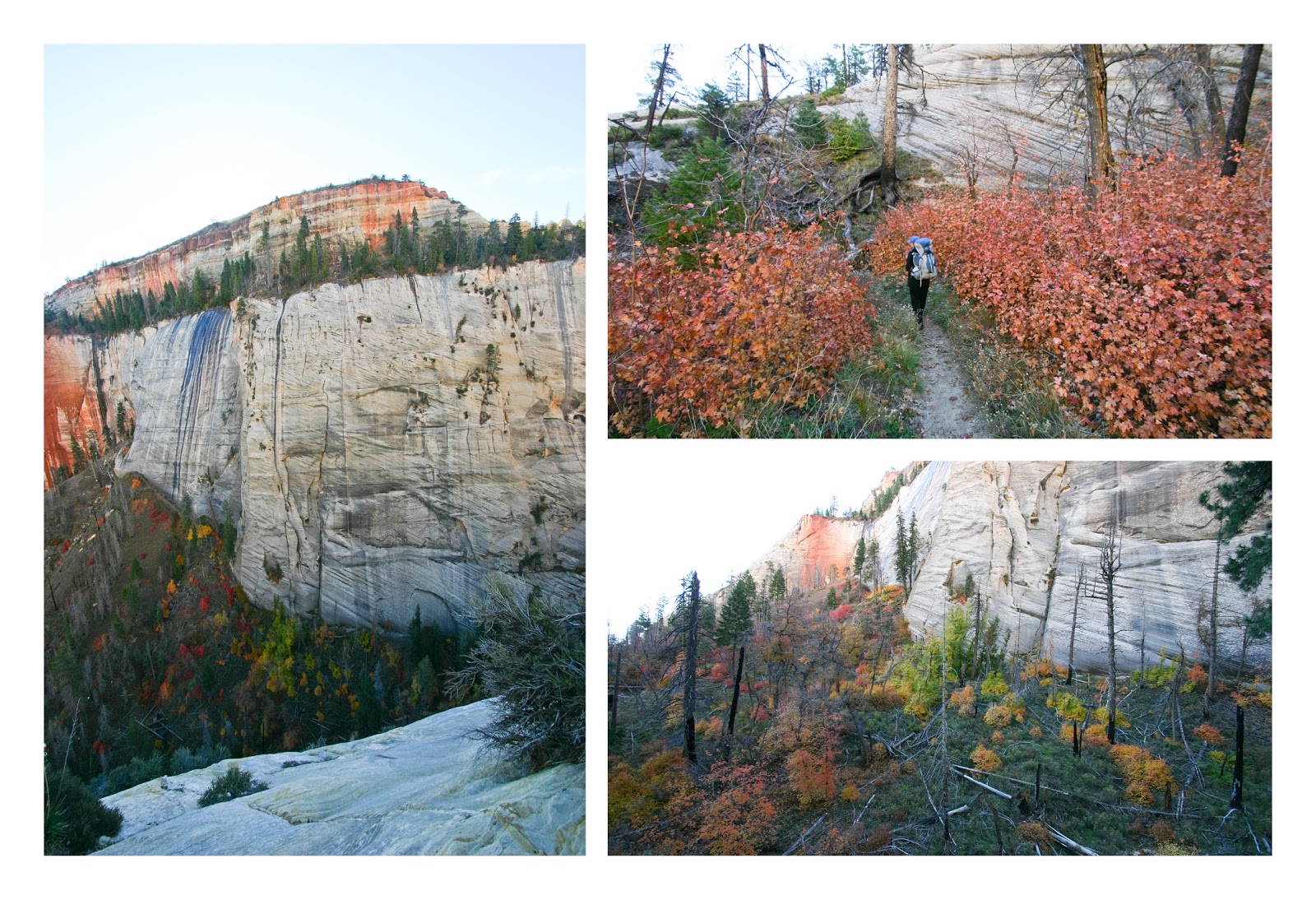
The trail starts off by crossing a plateau through open fields dotted with huge pines that still showed the scars of a forest fire that went through in 1995.  It warmed up quickly however and we made good time.  So good in fact that we ended up at our intended campsite just after 11 am.  Apparently “somebody” (OK, it was me) had grossly overestimated the time it would take to reach the campsite.  But it was early, the weather was clear and cool, and we hadn’t yet reached the rim of the canyon (and therefore the spectacular views we came for), so we decided to keep moving.


The challenge with backpacking in the desert is:

a) water is in short supply (I know, shocker, right?), and
b) water is obscenely heavy.

These two things don’t go well together.  It is commonly accepted that you need to drink at least 1 gallon of water per person per day – more if you are doing any physical activity.  Add another gallon for cooking and for two people for two days you are looking at about 8 gallons of water - weighing in at a breezy 64 lbs!

So unless you are planning to carry a 100 lb pack or are intent on dying of thirst, you have to plan on finding water as you go.  It is pretty darn important.  The campsite we were leaving was next to a tiny spring.  The next campsite with a spring nearby was another five or six miles down the trail. So overall we covered just over 10 miles before stumbling into our new campsite later that afternoon and learning a very valuable lesson:  eight miles in one day, at elevation, with a heavy pack is more than enough.  Ten miles is too much.


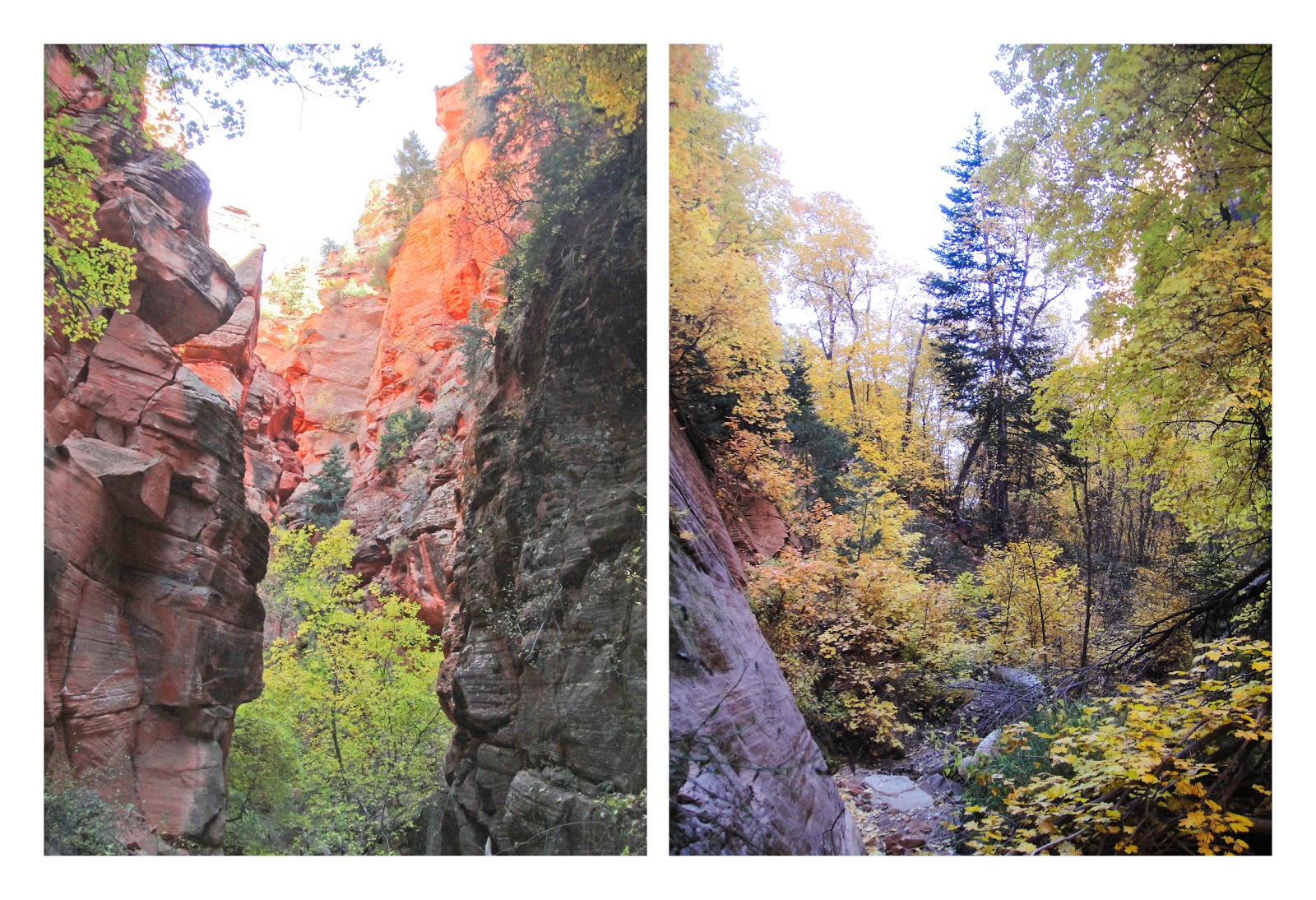
That said, once we got across the plateau and started following the rim of the canyon the scenery was great, and that made it all seem worthwhile.


We set up our tent at the top of a 1000 ft cliff overlooking a beautiful canyon valley, heated up a foil packet of dehydrated chicken risotto for dinner, boiled some water for coffee and watched the sun go down.  Then we ran like hell and climbed into our sleeping bags as the temperature started to plummet...


Morning came with a beautiful sunrise and the distinct realization that it was getting much too chilly to be sleeping in a tent this high up in the mountains.  From now until spring it will be day hikes.


With the tiny spring, getting water was a chore.  It bubbles up out of the ground in a barely perceptible flow, and then almost immediately drops over the edge of the cliff.  We had to use a piece of bark to channel it into a pot, taking five to ten minutes to gather one pot full.


Fortunately, our extra efforts the day before left us with only 4 miles to go – and it was all downhill.  Easy right?  No problem?  We had thought so.  Why then did it feel far, far worse than the day before?

First of all we were already sore from the previous day, and second, the last four miles decended a knee busting 3000 ft to the canyon floor.  Trust me - hiking downhill with a backpack only stinks slightly less than hiking uphill.


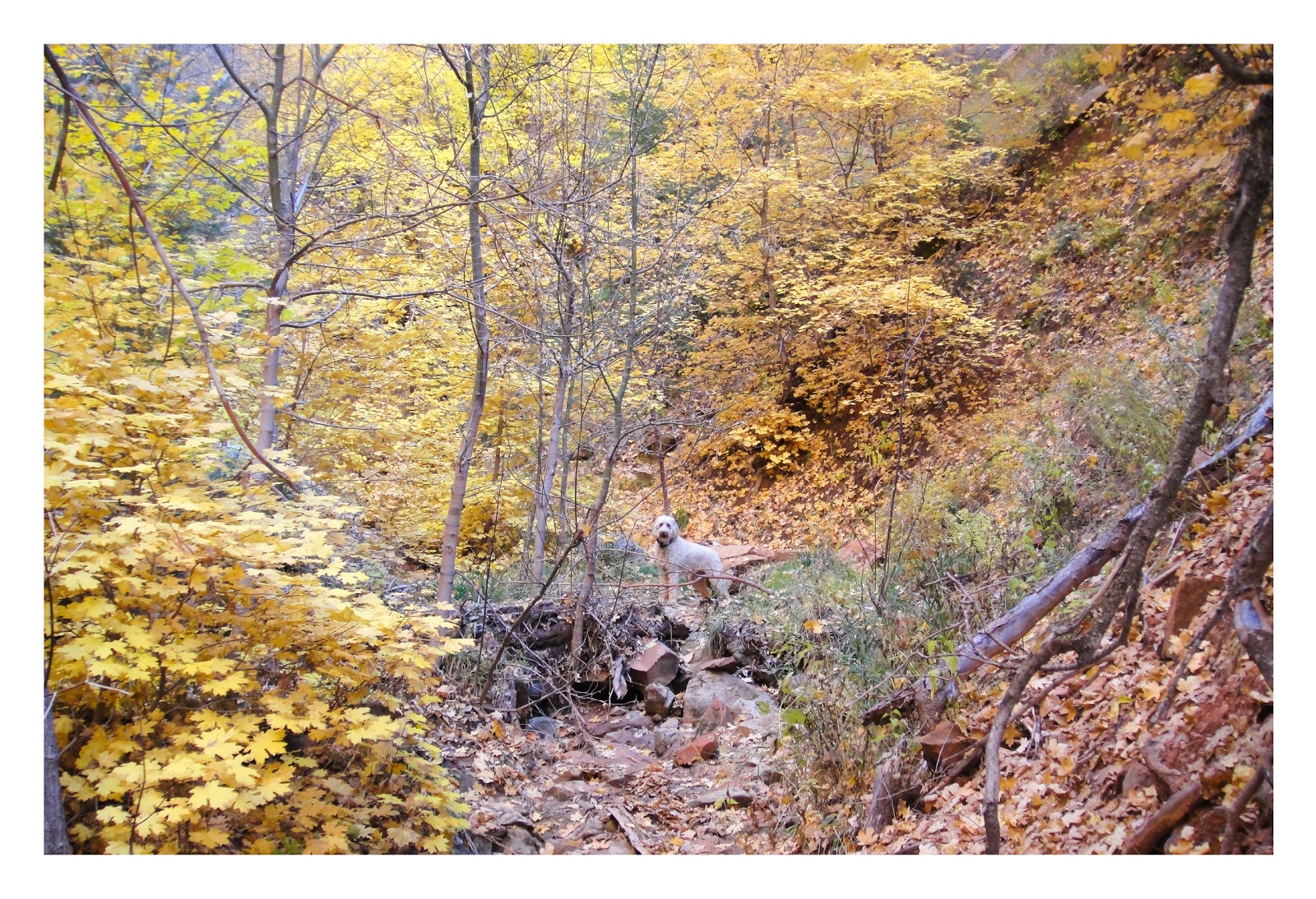
Again however, the scenery was incredible.  Trees were in full fall colors and as we approached the final decent to the floor of Zion Canyon the views went from beautiful to stinkin' spectacular.


On the way we passed a turn off for an infamous (and popular) trail known as Angels Landing.   Back in the 30's some unemployed people needed something to do, so the federal government poured money into the National Parks and told them to build stuff.  What did Zion do?  Build possibly the most dangerous hiking trail ever unleashed upon the general public.  Got a bum ankle or a crippling fear of heights?  Don't even think about it.  At one point you cross a ridge only a few feet across with a straight drop of over 1400 ft on either side.  To keep you from immediately falling to your death they have a chain for you to hold onto.  Not clip your harness into, not tie your self onto, just hold...

Considering we were already physically spent, we decided to give this short side trip a miss this time - but I will be back.  Oh yes, I will be back.


Remember the knee busting downhill descent I was talking about?  Here it is.


Almost at the bottom.  See how we are smiling?  Wrong.  Actually we were just gritting our teeth to take our minds off the pain in our feet.


Up next... Miscellaneous stories and photos and stuff!


Monday, November 5, 2012

Spring Creek Canyon

My beautiful wife turned 30 last week.  On the down side, that means I can no longer tell my buddies that I am married to a chick in her 20’s – something I have been milking for a long time.  On the up side however, since she somehow seems to get more amazing every year, I can excitedly look forward to our next year together even more than the year before. (For those of you who know her well, you know just how lucky I am, and are probably wondering how I ever snagged her in the first place.  P.S… I’ll never tell.)

Why am I prattling on about Stephanie you ask?  It is because otherwise she would be conspicuously absent from this post.  For her birthday she flew back to North Carolina to visit her Mom and a few of her closest girly friends.  They all rented a cabin in the mountains where I imagine they probably giggled a lot while drinking wine around a fire pit and eating bon bons in their flannel pajamas – but that is just a guess.  I anticipate she will create a post from that weekend, but in the meantime, I have a post of my own.

Here it is.

So with the wifey out of town it was just me and the dog sitting on the couch watching Breaking Bad and eating block of cheese.  Ah the life of a bachleor!   And if you know me at all, you will know that lasted about 30 minutes before I was horribly bored and pacing the floor looking for something to do. So Maggie and I decided to go hiking. (Actually it was mostly my decision, but I am pretty sure she agreed.)

My first idea was to climb a mountain - something I have been putting off since I got here.  There is one mountain in particular which has been rubbing me the wrong way - peeking at me tauntingly over the sandstone cliffs to the Northeast.  Unfortunately after quickly researching the idea of climbing one, it turns out that most of the mountains in this area are - not surprisingly - somewhat large and what they call “very challenging”.  It is as though they are specifically designed to prevent people like me – with limited physical stamina - from ever climbing them.  With some quick calculations, I quickly deduced that the chances reaching the top of one and getting back down again before dark was… let’s say risky.  (OK fine… it was suicidal.)  So after careful consideration, and remembering that Stephanie specifically made me promise “I won’t kill myself climbing a mountain while you’re gone” (she made me look her in the eyes and repeat that part twice), I decided on a canyon instead.  At least it would be a narrow canyon with big choke stones and the danger of flash floods so that made me happy.


If you look at a list of hikes in the Saint George area, chances are Spring Creek Canyon won’t even appear.  That is just the way it goes out here.  There are simply so many great hikes to do, that some have to be left out just to keep things sensible.  This one is especially overlooked, mostly because it falls just outside the boundaries of Zion National Park.

These are the hikes I look for.  Overlooked means no people.  Outside the park means Maggie can come along.  Perfect.


What I realized right out of the gate is that I hit the timing for this hike perfectly.  The bottom of this deep and narrow slot canyon is lined with scrub oak trees that were at the height of their yellow fall colors.  This mixed with a few orange and red maples, dark green junipers and the red rocks of the canyon walls made for some incredible scenery.


This is a great slot canyon with smooth shear walls reaching over 750 feet high, and in a few places as little as 5 – 6 feet across.  Think of walking down Wall Street if the buildings were only 5 ft apart.  That said, it turns out it was mostly easy hiking, with only a few places where the canyon was choked with boulders that you had to climb over to keep going.


Maggie was a great companion.  She is an experienced hiker but her short dog legs can make scrambling over large boulders difficult.  Fortunately, from previous outings, she has learned that when she approaches an obstacle she can’t surmount on her own, she stops and waits patiently for me to pick her up and push her up and over – an insult she would never normally abide.  Coming down off a ledge is even funnier – she crouches down and inches right up to the edge so I can get an arm under her and gently lift her down.  She runs around excitedly in figure 8’s after each one as if we just conquered Everest.


It still blows me away that scenery like this is right out our back door.  We left the house at about 1 pm, were on the trail before two, knocked out a 7-8 mile hike and were back home again in time for dinner – alive and well.  As promised.

Up next… Two days on Zion’s West Rim Trail.